Friday, 27 April, 2018, 5pm, Keynes Library, please book your (free) place here
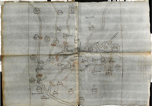
Ferdinand Opll: The Battle of Maps: Ottoman-Habsburg antagonism as mirrored in their cartography (15th – 16th century)
The paper will compare parallel trends in the development of Eastern (Islamic) and Western (Christian) cartography from the Early Middle Ages up to the Early Modern Times. This will lay the basis for a deeper understanding of the use of cartography as a tool in the context of the long-lasting political antagonism and territorial struggles between the Ottomans and the Habsburgs – the Muslim and Christian arch-opponents of the 15th and especially the 16th century. The paper will focus on reciprocal influences as well as deep diversities concerning (carto)graphical evolution in these two opposing camps. This comparative view will shine an interesting new light on the encounters of these two world powers of the Early Modern era and through a prism of oft marginalised medium of mapmaking.
Ferdinand Opll is Honorary Professor of Medieval History and Historical Auxiliary Sciences at the University of Vienna. He is a distinguished, awarded-winning historian and archivist who has authored and co-authored many landmark publications on Vienna’s history and topography. An able and dynamic administrator, as well as scholar, Ferdinand Opll has shaped a number of important institutions: he was the director of the Vienna Municipal and Provincial Archives (Wiener Statdt- und Landesarchiv) between 1989 and 2010; the leader of the Institute Municipal Historical Research of the Ludwig Boltzmann Society (Institut für Stadtgeschichtsforschung der Ludwig Boltzmann Gesellschaft) between 2002-2009, and the general secretary of the Society for the History of Vienna (Verein für Geschichte der Stadt Wien) between 1989-1991. He is an active member of the International Commission for History of Towns.


Leave a Reply